Shatt Al Arab
A Mesopotamian Confluence and a Civilizational & Strategic Waterway within the ROPME Sea Area
Shatt Al-Arab is considered one of the most important waterways within the marine region of the Regional Organization for the Protection of the Marine Environment (ROPME), due to its major geographical, environmental, historical, and economic significance. The river is formed by the confluence of the Tigris and Euphrates rivers in the Al-Qurnah area north of Basra in southern Iraq, before continuing its flow toward the Gulf at the city of Al-Faw, in the far south of Iraq.

Historically, Shatt Al-Arab was known as “Dijla Al-Awra” prior to the 5th century AH. Throughout history, it served as a vital artery for trade, navigation, agriculture, and human settlement in the region, and its name became closely associated with the history of the Gulf and the political and economic transformations witnessed across the area.
Geographic Location and Natural Formation
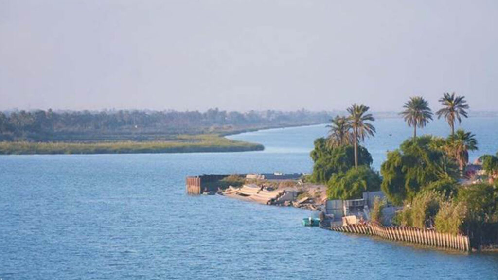
Shatt Al-Arab originates from the meeting point of the Tigris and Euphrates rivers at Al-Qurnah. Its length ranges between approximately 190 and 204 kilometers depending on different measurement methods, while its width varies from around one kilometer near Basra City to more than two kilometers at its mouth in the Gulf.
The river extends southward through several important Iraqi cities and regions, including Basra, Karma Ali, Al-Tanuma, Abu Al-Khasib, and Al-Faw.
A network of canals, marshes, and waterways branches out from the river, historically contributing to the formation of one of the most fertile agricultural environments in the region, particularly for date palm cultivation.
The banks of Shatt Al-Arab are distinguished by dense palm groves that were once among the largest concentrations of date palms in the world, despite the severe damage they suffered during recent decades due to wars, environmental changes, and neglect.
Geological Environment of Shatt Al-Arab
Geological studies classify southern Iraq, particularly the Shatt Al-Arab region, as an area with incomplete geological formation. It developed over thousands of years through the accumulation of river sediments carried by the Tigris, Euphrates, Karun River, and western valleys. Several researchers believe that these sediment deposits created natural barriers that hindered the direct flow of Mesopotamian waters into the Gulf, resulting in the formation of water depressions where water accumulated before gradually flowing to form the present-day course of Shatt Al-Arab. The region has also undergone continuous changes in waterways and sediment deposits due to tidal action and both natural and human influences, making it a highly dynamic environment of significant geomorphological importance.
Environmental and Agricultural Importance
Shatt Al-Arab represents a rich and diverse ecosystem, combining freshwater flowing from the Tigris and Euphrates rivers with saline waters coming from the Gulf, thereby creating a unique transitional environment that supports numerous plant and animal species.
Historically, the region was famous for date palm cultivation, containing millions of palm trees that formed an important economic and food resource for the population of southern Iraq. The abundance of freshwater also contributed to the establishment of thousands of canals and agricultural waterways since the early Islamic periods.
Distinctive natural and scenic areas spread along the banks of Shatt Al-Arab, including Al-Sayyab Corniche in Basra, Al-Qasr Corniche, and the orchards of Al-Tanuma and Abu Al-Khasib, all reflecting the region’s unique environmental and cultural heritage.
Economic and Strategic Importance
Shatt Al-Arab holds exceptional strategic importance as Iraq’s primary maritime outlet to the Gulf and one of the region’s most significant waterways. Its importance is reflected in several key aspects, including:
Maritime Navigation
Shatt Al-Arab serves as a major navigation route for commercial vessels and oil tankers, with maritime traffic extending from its outlet in the Gulf to the ports of Basra, including Al-Maqal Port.
Oil and Energy Sector
The importance of Shatt Al-Arab increased significantly following the discovery of oil in Iraq and Iran during the early twentieth century, becoming a vital corridor for transporting and exporting oil through the Gulf to global markets.
Agriculture and Water Resources
The river has historically served as a primary source of freshwater and irrigation, contributing to the prosperity of agricultural activities, particularly date palm cultivation and traditional crops in southern Iraq.
The Treaty of Zuhab
(Qasr Shirin)
The Treaty of Zuhab (Qasr Shirin) –
The Second Treaty of Erzurum
The Constantinople Protocol
The 1937 Agreement between Iraq and Iran
The Algiers Agreement
Algiers Agreement of 1975
Shatt Al-Arab remained under full Iraqi sovereignty until the signing of the Algiers Agreement in 1975 between Iraq and Iran, which stipulated the adoption of the thalweg line (the deepest navigable channel) as the boundary between the two countries in parts of the river.
Under the agreement, Shatt Al-Arab became an international shared river between Iraq and Iran in certain sections, while full Iraqi sovereignty continued over its northern parts up to the Muhammarah area.
This agreement marked a major turning point in the river’s history, particularly due to its connection with the political and security developments that later unfolded in the region.
- Declining freshwater levels
- Increasing salinity
- Industrial and oil pollution
- Degradation of palm groves
- Declining freshwater levels
- Impacts of wars and armed conflicts
- Accumulation of debris and sediment in certain areas
These challenges have directly affected biodiversity, agricultural activities, and local communities dependent on the river.
Shatt Al-Arab within the Framework of Regional Environmental Interest
Shatt Al-Arab represents an important component of the marine ecosystem within the ROPME Sea Area due to its direct connection to the Gulf and its influence on water quality, coastal habitats, and biodiversity.
The importance of regional cooperation in protecting this vital ecosystem is reflected through:
- Promoting sustainable water resource management
- Reducing marine and oil pollution
- Supporting environmental and geological studies
- Protecting coastal ecosystems and marshlands
- Conserving biodiversity and natural resources
Shatt Al-Arab remains both an environmental and civilizational witness to the region’s history and one of the most important rivers linking the natural environment with the cultural and economic identity of the peoples of the Gulf and the ROPME Sea Area.