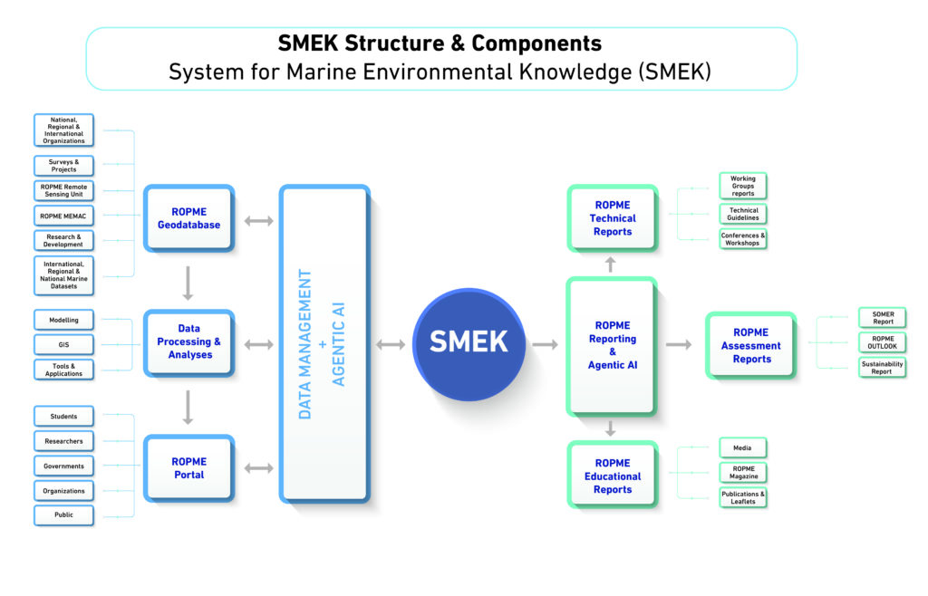
SMEK is an Integrated System for Marine Environmental Knowledge
In the ROPME Sea Area (RSA), there is a critical need for relevant, timely, reliable, and accessible marine data, information, and knowledge.
Why SMEK matters
High-quality data and information are essential for marine research, observation, assessment, decision-making, and management of marine ecosystems and resources in the RSA.
Goal II,” PROMOTE KNOWLEDGE TRANSFER & INNOVATIVE RESEARCH” of the ROPME Sea Area Strategic Directions 2026-2030, is to establish an integrated, interoperable observation, information, and data management system for the ROPME Sea Area (RSA). This includes harmonised data collection, monitoring, and reporting, as well as strengthened dialogue with national, regional, and global science policy bodies and decision-makers. As part of this goal, ROPME will leverage Agentic AI systems to enhance real-time monitoring, automate data validation, support predictive modelling, and transform raw observations into actionable insights.
The “knowledge goal” also reinforces ROPME’s role in translating regional efforts into national outputs across monitoring (e.g., harmonising indicator development, consolidating regional datasets), assessment and modelling (e.g., coordinating regional assessments that aggregate multi-source data), and information management (e.g., visualising trends, producing AI-supported forecasts, and delivering decision-ready intelligence)
What is SMEK?
This newly developed SMEK system by ROPME aims to establish a modern, integrated observation and information management system for the ROPME Sea Area (RSA) that will deliver and share vital information and marine data to ROPME Member States, the scientific community, and the public. SMEK will also connect to national, regional, and global marine observation systems, databases, and networks. The SMEK program will feature a robust digital infrastructure and marine geographic database, supported by geographic information systems (GIS), computer models, innovative applications, and a web portal. The main activities of SMEK will include:
Core components of SMEK
Digital Infrastructure
a robust ROPME marine database supported with structured domains, data flow, geographic information systems (GIS), remote sensing, and smart web applications

ROPME PORTAL
a new ROPME Portal supported with digital platforms and hubs dedicated to data sharing, knowledge transfer, publishing, and reporting.

AI Platforms
Develop and operationalise a Regional Agentic-AI Platform that integrates multi-source marine data (satellites, sensors, national monitoring networks, modelling outputs) into a continuously self-updating “digital twin” of the ROPME Sea Area, enabling automated anomaly detection, predictive forecasting (e.g., pollution events, HABs, climate-driven risks), and real-time decision support for Member States.
Computer-Assisted Models
Developing ROPME coastal and marine regional computer-assisted models to support monitoring, visualisation, analysis, forecasting, and decision-making.
Policy & Decision-Making Support
Developing ROPME Policy and Decision-Making Support and Reporting Tools to:
: i) inform policymakers and decision-makers on the status and health of the ecosystems in RSA;
ii) enhance policy implementation, regulations, and strategies for marine protection.
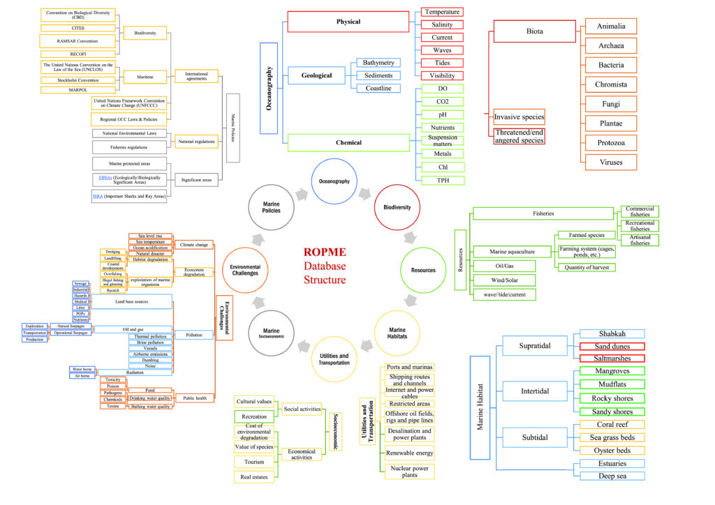
ROPME Marine Environmental Database
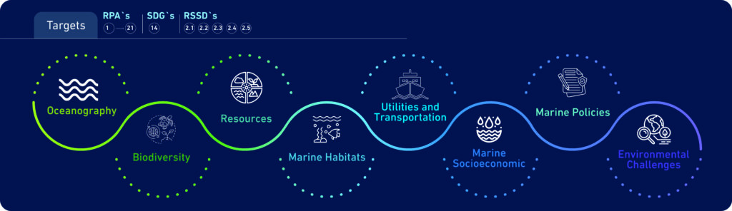
The newly developed ROPME Marine Environmental Database is structured to include eight domains, 30 sub-domains, and over + 150 layers. It will provide ROPME member states with information and knowledge on oceanographic measurements, bathymetry, biodiversity, habitats, satellite imagery, environmental challenges, marine policies, and many other topics.