Home
Organization
About Us
Council
Legal Frameworks
Our Mission
Our Vision
Our History
Our Strategy
Member States
Speech
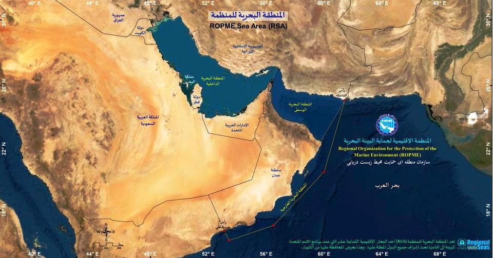
Our Sea Area
Background
Geological Formation
Geographical Extent
The Gulf
Gulf of Oman
The Arabian Sea
Main Characteristics
Shatt Al-Arab
Strait of Hormuz
Challenges
MARPOL Special Area
From Space
Programs
Biodiversity Conservation (BCP)
Pollution Prevention (PPP)
Climate Change (CCP)
System of Marine Environmental Knowledge (SMEK)
Research & Development (RDP)
Collaboration & Engagement Program (C&EP)
Blue Outreach Program (BOP)
Outreach
Publications
SOMER
Technical Reports
Books
Blue Juniors
Articles
Multimedia
Video Gallery
Photo Gallery
Blue Education
Search
Home
›
Maps
ROPME interactive maps
April 22, 2025
A
Decrease font size.
A
Reset font size.
A
Increase font size.
Explore More
https://ropme.maps.arcgis.com/home/item.html?id=78cbb8a64aa84574940383bee7ecb97e
https://ropme.maps.arcgis.com/home/item.html?id=5971a4ad227e4a568c9ce367d79db208
https://ropme.maps.arcgis.com/home/item.html?id=94efd4b1fca442e098041f4dce2e70b8
https://ropme.maps.arcgis.com/home/item.html?id=c84f6ce5ead34c8789db5cd97138d886
https://ropme.maps.arcgis.com/home/item.html?id=cd57c7534425492891a4f3e17bbfe81b
https://ropme.maps.arcgis.com/home/item.html?id=9ecd2d6b69c140d7963157a9b28916f4
https://ropme.maps.arcgis.com/home/item.html?id=5ff6bba73a4244b9aacc5976a65e17e7
https://ropme.maps.arcgis.com/home/item.html?id=0ee20689264b42d6913279c71e6ca6a2