Origins
The ROPME Sea Area (RSA) is one of the world’s most unique semi-enclosed seas in terms of its ecological structure and its biodiversity composition. This uniqueness is the product of millions of years of dramatic geological evolution. Its current elongated form, hydrology, and topography are closely linked to its geological origins.
The story of the RSA begins more than 25 million years ago, during the Late Oligocene to Early Miocene epoch, when massive geological forces were at work beneath what is now the Arabian Peninsula. This period marked the collision between the Arabian Plate and the Eurasian Plate, forming the Zagros mountain structure range in the north and causing a flexure in the crust to the south, which would eventually become the basin of the RSA.
The Strait of Hormuz emerged as a tectonic depression formed by crustal movements and faulting, which was gradually filled with waters from the Indian Ocean, shaping the shallow seabed and defining the RSA’s elongated, semi-enclosed geometry.
Sea Level Changes
Sediment Deposition
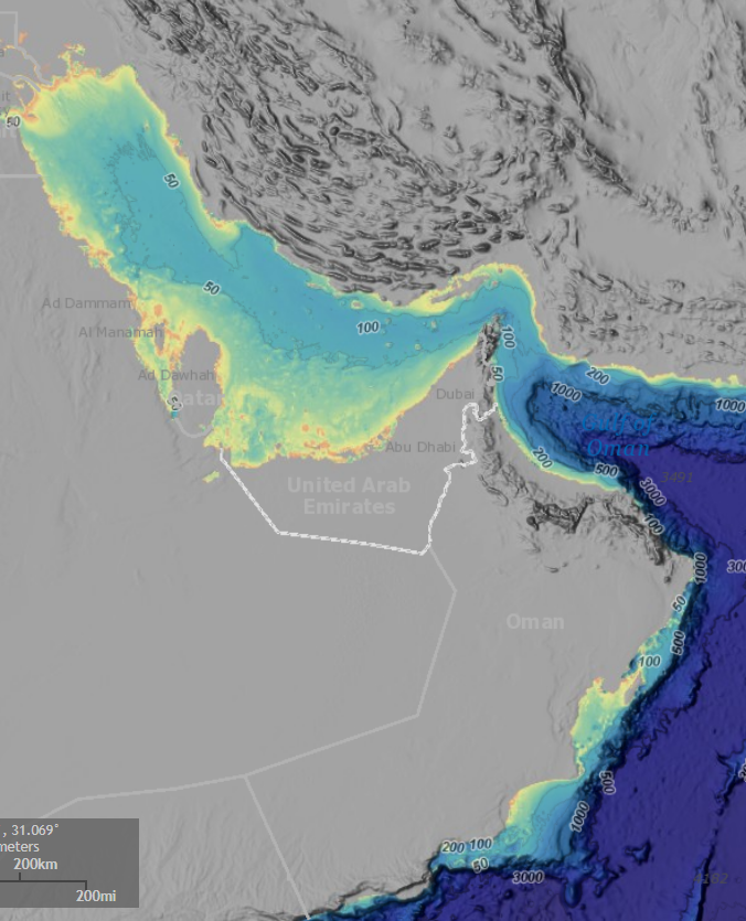
Bathymetry
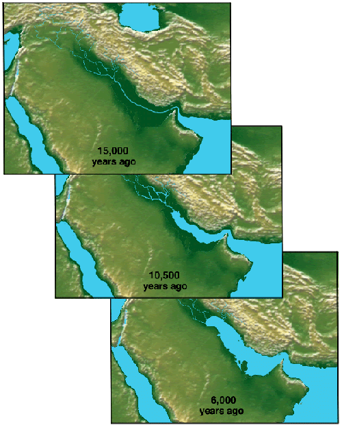
During the Pleistocene epoch (around 2 million years ago), global sea levels rose and fell dramatically due to glacial–interglacial cycles.
At various times, the RSA was completely cut off from the Indian Ocean, causing hypersaline conditions to dominate and shaping the evolution of species adapted to extreme environments.
During the Holocene transgression (around 10,000 years ago), sea levels rose again, flooding the basin into its current shape.
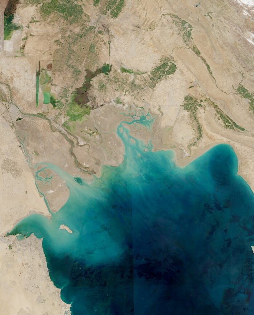
Over millions of years, huge volumes of sediments were deposited into the northern parts of the basin, particularly from the Tigris & Euphrates in the Shatt al-Arab river system. The northern RSA became a deltaic zone, filled with fine-grained muds and clays. The seafloor is extremely shallow in this area, with depths often less than 10 meter.
Much of the RSA is shallow, particularly in the Inner part, with depths rarely exceeding 50 meters. The Sea of Oman, by contrast, reaches depths beyond 3,000 meters and features more dynamic oceanographic processes.