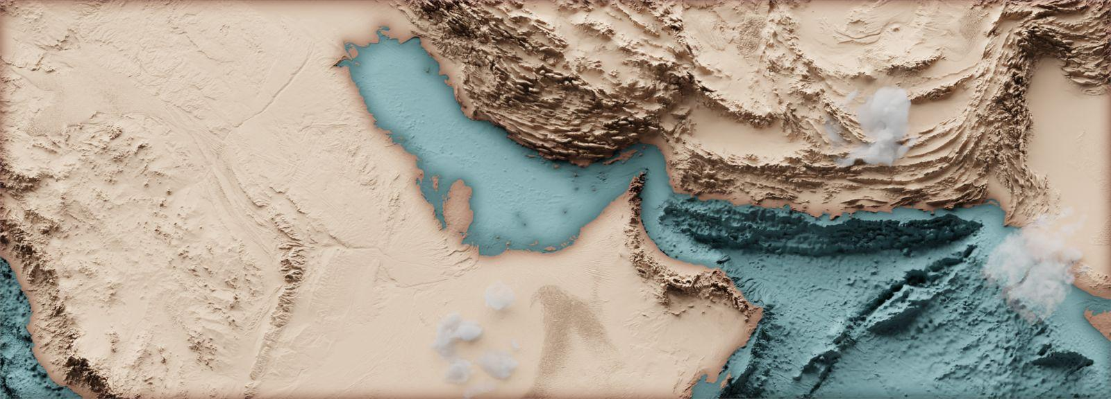
The RSA as Seen from Above
The ROPME Sea Area is one of the most environmentally sensitive and economically important marine regions in the world. Its heavy oil production, intense maritime traffic, fragile ecosystems, and vulnerability to climate change make continuous monitoring a necessity. Remote sensing from satellites provides ROPME with a powerful tool to observe these vast waters daily, offering real-time insights into pollution, natural hazards, and ecosystem health that cannot be achieved by traditional monitoring alone.
Recognizing the importance of this early on, ROPME established a dedicated Remote Sensing Unit (RSU) in 1996, following the Ninth Council of Ministers Meeting. To support the work of this unit, the ROPME Satellite Receiving Station was installed at ROPME Headquarters in Kuwait, giving the region its first near-real-time capability to track marine and coastal hazards. Since 2003, this 1st generation ground station has been fully operational until it was replaced by a more advanced 2nd generation station in the new ROPME Headquarters in 2018. This important equipment was managed and maintained by a team of specialized experts.
The ROPME ground station receives and processes daily data from multiple Earth observation satellites, including:
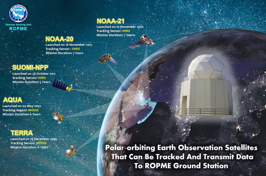
These wide-swath sensors allow ROPME to observe the entire RSA daily, ensuring rapid detection of sudden hazards while building a long-term environmental record.
What We Monitor
Through satellite observations, ROPME tracks a wide range of environmental and climatic variables across the RSA, including:
Climate Change Indicators → monitoring of sea surface temperature, chlorophyll-a trends, and long-term shifts in ocean productivity.
Oil Spills → detection, mapping, and risk assessment of spills and slicks.
Harmful Algal Blooms (HABs) → monitoring bloom extent, species impacts, and potential threats to fisheries and desalination plants.
Dust and Sand Storms → tracking frequency, extent, and their effect on air and water quality.
Tropical Cyclones → observation of storm development and trajectory for early warning.
Fires and Smoke → detection of terrestrial hotspots and smoke plumes impacting the marine environment.
Coastal Water Quality → assessment of turbidity, sediment transport, and circulation patterns, ch.
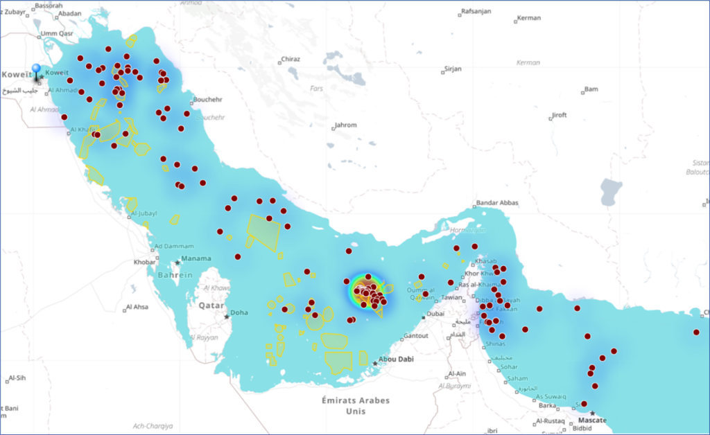
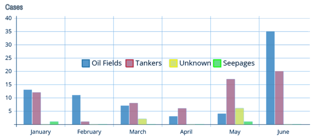
Sources Oil Spills in RSA
(1st Half of 2024)
Sources Oil Spills in RSA per month (1st Half of 2024)