

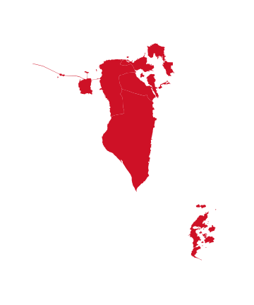

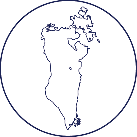
The Kingdom of Bahrain is located in the middle of the Arabian Gulf between latitudes 25.32 and 26.20 North and longitudes 50.20 and 50.50 East, close to the eastern coast of the Kingdom of Saudi Arabia.
The Kingdom of Bahrain is an archipelago consisting of 33 natural islands, and expansion projects have added additional islands to its territory, bringing the total number of islands to 84. The marine environment in Bahrain represents about 90.5% of the total land and water area belonging to the Kingdom of Bahrain, and more than 90% of the population resides along the coasts, which extend for more than 510 kilometers.
The Bahrain archipelago is located in the middle of the southern part of the Organization’s marine area, with its northern side connected to the open waters of the Gulf, and its southern side connected to Salwa Bay.
Terrain and Natural Characteristics
The climate of Bahrain is characterized by high temperatures and humidity during the summer season, while winter is mild. The average annual temperature ranges between 20 and 35°C, and the humidity ranges between 30 and 85%.
Annual rainfall is estimated at 13.4 mm, the average sunshine duration is 10.4 hours/day, and the average wind speed is 8.8 knots.
Desert plains constitute most of Bahrain’s terrain. As for arable land, it does not exceed 3%, and the Kingdom of Bahrain has no rivers.
The major islands of Bahrain, according to their size are:
- Bahrain Island, which makes up nearly 80% of the country’s total area.
- Hawar Islands
- Muharraq Island
- Umm an-Naʿsān Island
- Durrat Al Bahrain Island
- Sitra Island, which is the smallest of the main islands in terms of area.
There are also many secondary islands in Bahrain, the most prominent of which are:
- Diyar Al Muharraq Island
- Northern City Island
- Lulu Island
- Nurana Island
- Nabih Saleh Island
- King Fahd Island
- Jiddah Island
- Khalifa Bin Salman Island
- Halat al-Naʿim Island (consisting of two islands together)
- Umm al-Ṣabbān Island
- South Sitra Island
- Al Dar Island
- Lagoon Island

Coastal Khors (Inlets):
Hawar Islands Khors
Khor Al-Qurum
Khor Al-Janabiya
Khor Al-Hadd
Khor Al-Zallaq
Khor Shattiyah
Khor Al-Fadil
Khor Umm an-Naʿsān
Salinity Levels
The salinity levels along Bahrain’s coasts are considered higher than the global average for seawater due to the climatic and environmental conditions of the Organization’s marine area.
Bahrain’s coasts are among the high-salinity zones in the region, with average salinity along the western coasts ranging between 50–57 psu/ppt, while the eastern coasts have slightly lower salinity levels of 43–45 psu/ppt. This affects the marine environment and increases the challenges of water desalination.
Evaporation Rate
The annual evaporation rate in the Kingdom of Bahrain is considered very high compared to the global average due to the hot, dry desert climate, low rainfall, and high temperatures throughout the year. The annual evaporation rate ranges between 1.8 – 2.2 meters/year (≈ 1,800 – 2,200 mm).
The highest rates are recorded between June and September, and the lowest between December and February.
Coral Reefs
There are many coral reefs in the Kingdom of Bahrain along its northern and northeastern coasts. The largest group of small reef patches forms a chain that extends into deeper waters north of Bahrain. It is estimated that these reefs provide a larger area of substrate than all other coral islands within the internal marine zone of the region.
A total of 31 coral species, belonging to 19 genera, have been identified in the Kingdom of Bahrain.
The Nawwar (Nugwa) Bulthama Protected Area, located north of Hir Bulthama northeast of Bahrain Island and covering approximately 3.2 km², is an important component of the ecological balance for marine organisms in Bahrain’s territorial waters. It features some of the best coral reef species, algae, sponges, and anemones in the country. It is considered one of Bahrain’s most significant coral reef habitats, marked by a submerged rocky seabed rich in marine life such as algae, sponges, and anemones, representing a unique model of coral resilience under harsh environmental conditions.
Nugwa Bulthama also contains the highest percentage of hard coral cover in Bahrain, along with several soft coral species, mollusks, and other unique forms of biodiversity.
The most prominent coral reef sites in Bahrain include:
Fasht Al-Adhm, Fasht Al-Jarm, Hawar Islands, Fasht Al-Azari, Ras Al-Bar, Ras Al-Zallaq.
Most of these reefs are found at depths ranging from 2 to 10 meters.
Mangrove Forests
Mangrove trees have a high capacity to absorb carbon dioxide — 4–5 times more than other trees — and serve as essential habitats for crustaceans, marine organisms, and diverse bird species. This ecological importance has led the Government of Bahrain to expand mangrove planting efforts.
Natural mangrove forests in the Kingdom of Bahrain are found in the southeastern part of Bahrain Island, with limited presence in certain northern and eastern areas.
Major mangrove sites in Bahrain include:
Hawar Islands: Total area 0.05 km², vegetated area 0.01 km².
Ras Sanad: The largest natural mangrove stand in Bahrain, containing mudflats and relatively low-salinity waters. Total area: 0.5 km²; vegetated area: 0.18–0.22 km².
Tubli Bay: Total area 1.0 km²; planted mangrove area 0.45–0.5 km².
Khor Al-Hadd: Total area 0.1 km²; vegetated area less than 0.02 km².
Ras Al-Zallaq: Total area 0.05 km², vegetated area 0.01 km².
Seabed (Benthos)
The seabed refers to the marine floor that contains sediments, benthic organisms, and associated ecosystems such as seagrass beds and coral reefs. It is one of the most sensitive marine habitats to pollution and physical and chemical changes.
The marine zone of Bahrain covers approximately 8,250 km², representing most of Bahrain’s seabed. It consists largely of rocks, sand, and deep waters, with significant areas of algae, seagrasses, and coral reefs. Ecologically important habitats like seagrass beds and coral reefs — which form part of the seabed ecosystem — are concentrated around Fasht Al-Adhm, Fasht Al-Jarm, Nugwa Bulthama, Hawar Islands, and along the eastern and western coasts of the main island. These areas are considered top priorities for the protection and management of Bahrain’s marine biodiversity.
Coastal Wetlands
Marine environments in the Kingdom of Bahrain are classified into two main categories: coastal (intertidal) and marine (subtidal) environments.
The coastal environments include several distinct systems such as:
- Mudflats
- Rocky shores
- Sandy shores
- Salt marshes
- Mangrove swamps (8)
Coastal wetlands include mudflats, salt marshes, sabkhas (salt flats), and the buffer zones surrounding mangrove habitats. Mudflats are the most important wetlands in Bahrain.
The main coastal wetlands in Bahrain are concentrated in:
Doha Arad in Muharraq Island
Tubli Bay and surrounding areas (northeast Bahrain)
Southwest coast
Ras Hayyan (southeast coast)
Hawar Islands and their surrounding shallow waters
Power Production Stations
Electricity in the Kingdom of Bahrain is generated through power production stations owned by private-sector companies, while the Electricity and Water Authority oversees the purchase of electricity from these companies and coordinates with them through the Control Center.
Water is produced from six advanced desalination plants that operate using both reverse osmosis and thermal desalination technologies, with a production capacity of 213 million imperial gallons per day.
The Authority is responsible for managing these facilities to ensure the provision of clean, reliable, and sustainable water in accordance with local and international standards.
The most prominent power and water production facilities in Bahrain are:
Hawar Reverse Osmosis Water Desalination Plant
Al-Hadd Housing Water Distribution Station
Al-Hadd Housing City Stations (1 and 2) for electricity transmission
Al-Ramli Water Distribution Station
Khalifa City Water Distribution Station
Salman City Water Distribution Station (Phase II)
East Sitra Water Distribution Station
Hawar Project
“Kafaa” Project (a national initiative to improve energy efficiency in high-consumption buildings)
Al-Hunayniyah and South Saar Water Distribution Stations
Al-Dur Solar Power Plant Project
Al-Jasra Station
Solar Power Field at the University of Bahrain (under a Power Purchase Agreement scheme)
Solar Independent Power Plant in Bilaj Al-Jazair
Al-Hamala Reverse Osmosis Water Production Plant
Major Coastal Resorts and Chalets
Hawar Resort (Hawar Islands)
Laguna Beach Resort (Al-Budaiya)
Sofitel Bahrain Hotel (Zallaq)
Jumeirah Gulf of Bahrain (Zallaq)
The Art Hotel & Resort (Amwaj Islands)
Grove Resort (Amwaj Islands)
Novotel Al Dana Resort
Address Beach Resort (Diyar Al Muharraq)
VIDA Beach Resort Marassi Bahrain (Diyar Al Muharraq)
Sources:
– Electricity & Water Authority, Kingdom of Bahrain
– Bahrain Tourism & Exhibitions Authority (2025)
Protected Areas
The total area of protected zones (terrestrial and marine) in the Kingdom of Bahrain is estimated at 20.6% of the country’s total area, according to the indicator issued by the World Bank on global protected areas for the year 2024.
Natural Marine Protected Areas in Bahrain
Hawar Islands Protected Area
Located about 26 km southeast of Ras Al-Bar on Bahrain Island, this reserve forms an archipelago of 16 desert islands.
It is distinguished by its pristine environment, natural beauty, clarity, and natural geographical distribution, as well as its unique wildlife.
The reserve attracts numerous bird species that live and breed there at different times of the year.
The surrounding territorial waters of the Hawar Islands host one of the largest herds of dugongs in the world.
Mishthan Island Protected Area
Located southeast of Bahrain Island and north of the Hawar Islands, with a total area of about 18.61 km².
The island and its surrounding marine area are significant for biodiversity in Bahrain, as many important marine plants grow there. The area also serves as a habitat for many marine species of direct economic value.